Hunter Tree Farm at Christmas 2025

In the early 1950s the growing Wedgwood neighborhood attracted businesses like groceries, gas stations, home improvement stores and services such as medical & dental offices.  One other new business in Wedgwood, Christmas tree sales, was very successful.

William O. & Carol Hunter of Shelton, Washington, brought Christmas trees to the Wedgwood neighborhood in Seattle, beginning in the 1950s.  Their Hunter’s Tree Farm sales site still exists today at 7744 35th Ave NE.  This year it is open for seasonal sales from November 24 to December 24, 2025.

Continue reading

Posted in Events and holidays, Hunter's Tree Farm, Neighborhood features | Tagged , , , | Leave a comment

Candy Cane Lane in December 2025

A fun favorite event in December 2025 is the annual Candy Cane Lane, a street in Ravenna which is decked out with lights and holiday decorations.  Candy Cane Lane is located on Park Road NE, just off of NE Ravenna Blvd, aligned with 21st Ave NE.

Candy Cane Lane location map, Park Road NE off of NE Ravenna Blvd.

The first night of lights is Saturday, December 6, 2025, at 4 PM, and it is pedestrian-only; no cars driving though.

Candy Cane Lane will be open every night through Thursday, January 1, 2026.  Go to the Facebook page of Candy Cane Lane for more info including the list of other pedestrian-exclusive nights.

You are encouraged to bring canned goods to contribute for University Food Bank.  Donation bins are at the end of the street.

Read more here for the history of Candy Cane Lane.

Carousel display at Candy Cane Lane on Park Road NE

Posted in Events and holidays | Tagged , , , | Leave a comment

Who were Burke & Gilman?

The Evanston Steps in the Fremont neighborhood, leading to the Burke-Gilman Trail and providing a good view of boat traffic on the ship canal. Photo by Valarie, August 2025.

One of Seattle’s amenities is a trail which traverses the city and extends to the east side of Lake Washington.  Sometimes called “Seattle’s longest park,” the trail is overseen by the Parks Department and serves those who walk, run, or travel by bicycle for exercise or to commute to work.

In the 1970s the name “Burke-Gilman Trail” was given to this former rail line when a group of Wedgwood neighbors advocated for its conversion to a trail.  In another article on this blog I have told the story of how the committee came up with the Burke-Gilman Trail idea.

The members of that 1970s citizen-activist group suggested that the names of Thomas Burke & Daniel Gilman be given to the trail, because in the 1880s these men were the key movers-and-shakers in the creation of Seattle’s own railroad, called the Seattle, Lake Shore & Eastern.  In this blog article I will explore some of the reasons why these men, Burke & Gilman, came to Seattle, what their lives in Seattle were like, and the legacy they left.

The Burke-Gilman Trail proceeds along the north shore of Lake Union and over to Lake Washington to the east.

Continue reading

Posted in Neighborhood features, Seattle History | Tagged , , | 2 Comments

The Wedgwood Post Office

In 1946 McVicar Hardware became the first business to occupy a new storefront building owned by Henry R. Hansen of the adjacent tavern.  Business owner Grant McVicar became a leader in the growing Wedgwood community, and one of his initiatives was to seek to establish a post office in the neighborhood.

The Wedgwood Post Office in the center of the neighborhood at 7724 35th Ave NE.  On its north side is the Hunter Tree Farm.   Photo by Valarie, August 2025.

Continue reading

Posted in businesses, Neighborhood features | Tagged , | Leave a comment

The Wedgwood Gardens Plant Nursery Business

In the 1930s the (future) Wedgwood neighborhood was an unnamed area outside of the Seattle City Limits.  Along 35th Ave NE, the three intersections of NE 75th, 85th and 95th Streets each had only one building: a tavern.

German immigrant John Herkenrath & his wife Freda built a house at 7724 35th Ave NE, present site of the Wedgwood Post Office.  John was semi-retired and did some carpentry work.  The Herkenraths owned the property from their house up to NE 80th Street, where today there is the Wedgwood Post Office, the Hunter Tree Farm lot at 7744 35th Ave NE, and the Grassy Lot on the corner owned by Wedgwood Presbyterian Church.

The Herkenrath house in 1958, present site of the Wedgwood Post Office at 7724 35th Ave NE. Seattle Municipal Archives photo #75875.

Continue reading

Posted in businesses, Controversies, Hunter's Tree Farm | Tagged , , | 1 Comment

Who Named the Wedgwood Neighborhood in Seattle?

Who gave the name of “Wedgwood” to this northeast Seattle neighborhood?

Henry R. Hansen lived in Wedgwood for only a few years, but he left a legacy: the naming of the neighborhood.  He didn’t do this on purpose, though.  Circa 1945 he changed the name of Hansen’s Tavern to the Wedgwood Tavern in a new building he had built on the same site, at 8517 35th Ave NE.

Continue reading

Posted in name of the neighborhood, Neighborhood features, taverns | Tagged , | Leave a comment

The Bentons of Ravenna Orchard in Seattle

The Benton family arrived in Seattle in the early 1900s and lived on 29th Ave NE in what is now the Ravenna-Bryant neighborhood, near Bryant School.

Beginning in 1906, the Bentons became real estate investors who sold lots and built houses on 28th & 29th Avenues NE.

Benton family members founded the Benton’s Jewelers company in 1909.  Today the street clock of Benton’s Jewelers is a reminder of this family’s impact in northeast Seattle.

Benton’s Jeweler’s street clock has been set up at the former Baskin-Robbins site at Union Bay Place NE, now Aegis Laurelhurst. Photo by Valarie, December 2023.  The site was fenced as of this photo because the Aegis Laurelhurst building was still under construction.

Continue reading

Posted in Houses, name of the neighborhood, Neighborhood features, Plat names, research resources, Seattle History | Tagged , , | Leave a comment

Illuminating Bryant

In the early 1900s Seattle neighborhoods were growing farther to the northeast, on the edges of communities such as Ravenna and the Town of Yesler.

Seattle Female College building as pictured in the 1890s, at 5702 26th Ave NE. Photo courtesy of University of Washington Special Collections.

Ravenna was a railroad stop at the intersection of Blakeley Street & 25th Ave NE.  The Town of Yesler grew at the present site of Laurelhurst where, in the 1880s, another Yesler sawmill had operated in addition to the Yesler Mill of 1853 on the downtown Seattle waterfront.

One of northeast Seattle’s earliest church groups began in 1901, calling itself the Yesler Sunday School.  Later it was called Ravenna Methodist Church when it met at the former Seattle Female College building at 5702 26th Ave NE.  Then finally the group built a church building which still stands today on NE 60th Street in what is called the Bryant neighborhood.

Continue reading

Posted in churches, name of the neighborhood | Tagged , , , , | 3 Comments

Then and Now on NE 45th Street in Northeast Seattle

Those of us who grew up in the 1950s and 1960s in northeast Seattle lived in a world of shopping malls like University Village, fast food outlets like Taco Time, drive-ins like Burgermaster, and multiple gas stations which seemed to thrive in commercial districts.  The block of NE 45th Street from 25th Ave NE eastward to Union Bay Place NE was like this.  University Village Shopping Center opened in 1956, and to the east of it there were gas stations, a car wash, Taco Time and Burgermaster.

In February 1957, workers on the NE 45th Street Viaduct looked out over University Village and the Carnation Dairy plant. Seattle Municipal Archives item #54114, Engineering Dept., colorized photo.

Our 1950s-1960s memories of NE 45th Street are of the second phase in its development.  Its first phase began in the 1920s when the site of University Village was farmland, and to the east was a gas station and a corner market.  In a photo of the NE 45th Street Viaduct under construction in 1939, looking eastward, we see the farmland and a couple of gas stations and stores beyond it.

In 1939 during the original construction of NE 45th Street Viaduct, we look out over the farmland which became University Village in 1956. Photo of May 1939, colorized; Seattle Municipal Archives item #38898.

Continue reading

Posted in businesses, Neighborhood features | Tagged , | Leave a comment

Old-Time Stores and Gas Stations at Union Bay Place in Seattle

Residents of northeast Seattle called it “the Baskin-Robbins corner.”  The five-way intersection of Union Bay Place NE is at the east end of a long block, east of the University Village shopping center on NE 45th Street.

One branch of the intersection is called NE 45th Place.  The roadway angles up toward the northeast and passes under an old railroad trestle.  That railroad line has been preserved as the Burke-Gilman Trail.

The former train trestle, now the Burke-Gilman Trail, over the roadway from Union Bay Place up to 35th Ave NE. The Exposition Heights real estate development is on both sides of the road.

Those of us who grew up in the 1950s and 1960s can remember the small stores and the gas stations at the crossroads of Union Bay Place NE.  In addition to the nearby train trestle as seen in the photo above, the most outstanding landmark at Union Bay Place was the Baskin-Robbins ice cream store, one of the small buildings in a commercial district of one-story storefronts.

Today we see that the character of the Union Bay Place intersection is being transformed with the construction of one much larger building, Aegis Laurelhurst, taking up the whole block of the former Baskin-Robbins and other storefronts.

Aegis Laurelhurst under construction as of December 2022, replacing the Baskin-Robbins corner at Union Bay Place NE. Photo by Valarie.

This blog article will trace the evolution of the intersection from the first buildings built in the 1920s and 1930s.

Continue reading

Posted in gas stations, Land records and surveys, Neighborhood features | Tagged , , | 3 Comments

The Rite-Aid Building in Wedgwood

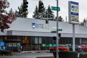
UPDATE:  The Wedgwood Rite-Aid store 8512 35th Ave NE, closed on July 20, 2025.  Rite-Aid does not own this building, so in August 2025 the property owner is trying to lease the building to another business.

This blog article is a historical retrospective on the Wedgwood business district, specifically the intersection of NE 85th Street.

Wedgwood takes shape in the 1940s

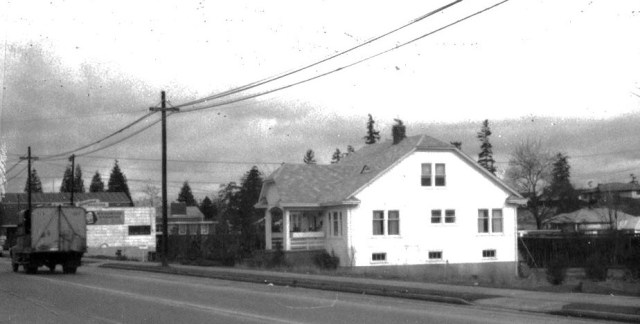
In the 1940s Wedgwood was just beginning to take shape as a neighborhood with a commercial district. At the intersection of NE 85th Street on 35th Ave NE, there was only one building, Hansen’s Tavern, on the northwest corner, as of 1945.

The new Wedgwood Public House opened on November 2, 2024, in the former Wedgwood Ale House.

In 1945-1946 the tavern owner rebuilt the building to include storefronts, and he re-named his business the Wedgwood Tavern.  The first store to open in the new building adjacent to the tavern was McVicar Hardware, 8507 35th Ave NE.

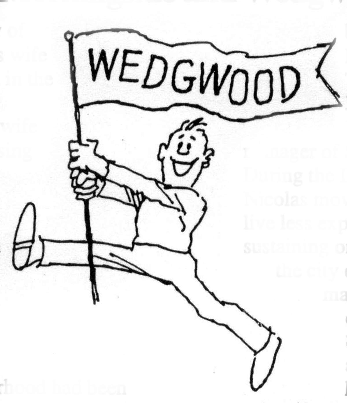
As of 1945-1946 the tavern (as of 2024, it is called the Wedgwood Public House at 8515 35th Ave NE) was the first of the neighborhood businesses to name itself after the nearby Wedgwood housing development built by Albert Balch.  The naming “caught on” as other businesses began to use it.

In the 1940s developer Albert Balch gradually acquired ownership of the other three corners of the intersection at NE 85th Street, which he reserved for commercial buildings.  The intersection grew with a variety of stores in response to the population growth of Wedgwood.  Today the intersection of NE 85th Street on 35th Ave NE is the heart of Wedgwood’s business district.

Continue reading

Posted in businesses, grocery stores | Tagged , , , | Leave a comment

Names in the Neighborhood: Wedgwood’s Boundaries and Neighborhood Identity

Wedgwood banner cartoon by Bob Cram, Wedgwood Community Council Newsletter of March 1996.

Wedgwood banner cartoon by Bob Cram, Wedgwood Newsletter of March 1996.  All rights reserved; do not copy.

In the early 1900s Wedgwood in northeast Seattle did not have a name or a definite identity as a neighborhood.  It took a post-World-War-Two growth spurt in population, and a housing development by Albert Balch, for the neighborhood to coalesce around the plat name he had chosen, “Wedgwood.”

Some areas in or near Seattle, such as the Fremont neighborhood, had been founded with an official name.  In May 1888 an investors group including Edward & Carrie Blewett from Fremont, Nebraska, platted Fremont, Seattle as a townsite.  This was the official “start date” of the Fremont neighborhood.  As soon as lots began to be sold in 1888, there was a kind of land rush to populate Fremont.  In contrast, Wedgwood had no developers, planners or official name in early years.

Northeast Seattle areas including Wedgwood grew very slowly over many decades.  The biggest growth in Wedgwood came after World War Two ended in 1945, when serviceman returned home from the war and got married.  These young couples looked for housing to start their new lives.  Wedgwood began to acquire its neighborhood name in that era, after developer Albert Balch filed a plat of land and built houses called Wedgwood in 1941.   Wedgwood did not fully come into the Seattle City Limits until the 1950s.

Continue reading

Posted in boundaries, community club (old), name of the neighborhood, Neighborhood features | Tagged , , , , , , | Leave a comment

The Gateposts of Wedgwood

When Albert Balch, the developer of the Wedgwood neighborhood, put up stone gateposts at the entrance to his new housing area, he tapped into the gateposts’ symbolism of permanence and protection, qualities desired by young couples in search of homes.

Continue reading

Posted in Balch, businesses, gateposts, Neighborhood features | Tagged , | Leave a comment

The Trees of Autumn 2025 in Wedgwood

In the autumn season Wedgwood’s flame ash street trees enliven the arterial 35th Ave NE with brilliant color.

Flame ash street trees in the 9800 block of 35th Ave NE in October 2025. Photo courtesy of JRV.

Flame ash street trees in Wedgwood, as viewed from the corner of NE 87th Street in October 2025. Photo courtesy of JRV.

Continue reading

Posted in Neighborhood features, trees | Tagged , , | Leave a comment

The 2025 Pumpkin Season in Wedgwood

Wedgwood’s annual Pumpkin Party begins on Saturday, October 4, 2025.  This month the Hunter Tree Farm site, 7744 35th Ave NE, next door to the Wedgwood Post Office, is transformed into a Pumpkin Patch.  Local scout troops host pumpkin sales to raise funds for their programs.  The pumpkin sales will be open on Saturdays and Sundays through the last weekend of the month, October 25-26.

The Hunter Tree Farm site, 7744 35th Ave NE, is transformed into a Pumpkin Patch in October 2025. Photo by Valarie.

Continue reading

Posted in Events and holidays, Hunter's Tree Farm, Neighborhood features | Tagged , | Leave a comment

The Hudson Building in the 1920s

On the evening of July 4, 2025, a speeding car plowed into the Mioposto restaurant at 3426 NE 55th Street.  Diners were showered with broken glass, but fortunately no one was killed.  Immediately work began to reinforce the building’s storefront, as the main supporting post had been sheared away.

Above the storefronts, the parapet of the building has a letter H outlined in brick & tile, which set me on a quest to know what the “H” stood for.  I think it is likely the initial of John Stauffer Hudson who constructed the building in 1925.

This blog article will trace the background of John Hudson, his career as a builder in Seattle, and the story of the building at 3426 NE 55th Street.

Continue reading

Posted in Architecture, businesses, Seattle History | Tagged , , , | 1 Comment

House-Moving from the Freeway to Wedgwood

A house built in 1929 in classic style was saved from the path of freeway construction.

Throughout its history Seattle has attracted migrants from all over the USA.  This blog article will trace the journeys of families who came to Seattle, and the story of a house, ending with the migration of the house itself.

In 1967 a house at 7731 4th Ave NE had to be moved to get out of the path of Interstate 5 freeway construction.  The house was moved about two miles to the northeast, to 8512 30th Ave NE in the Wedgwood neighborhood of Seattle.

Continue reading

Posted in Civil War, Houses, Immigrant heritage | Tagged , , | 1 Comment