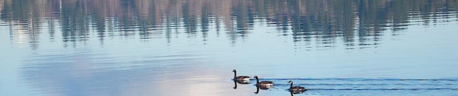
The Bentons of Ravenna Orchard in Seattle

The Benton family arrived in Seattle in the early 1900s and lived on 29th Ave NE in what is now the Ravenna-Bryant neighborhood, near Bryant School.

Beginning in 1906, the Bentons became real estate investors who sold lots and built houses on 28th & 29th Avenues NE.

Benton family members founded the Benton’s Jewelers company in 1909.  Today the street clock of Benton’s Jewelers is a reminder of this family’s impact in northeast Seattle.

Benton’s Jeweler’s street clock has been set up at the former Baskin-Robbins site at Union Bay Place NE, now Aegis Laurelhurst. Photo by Valarie, December 2023.  The site was fenced as of this photo because the Aegis Laurelhurst building was still under construction.

Continue reading

Posted in Houses, name of the neighborhood, Neighborhood features, Plat names, research resources, Seattle History | Tagged , , | Leave a comment

Illuminating Bryant

In the early 1900s Seattle neighborhoods were growing farther to the northeast, on the edges of communities such as Ravenna and the Town of Yesler.  Ravenna was a railroad stop at the intersection of Blakeley Street & 25th Ave NE.  The Town of Yesler grew at the present site of Laurelhurst where, in the 1880s, another Yesler sawmill had operated in addition to the Yesler Mill of 1853 on the downtown Seattle waterfront.

As of 1900 there was as yet no streetcar or bus system travelling into northeast Seattle farther than Ravenna Park.  There was only a railroad, the Seattle, Lake Shore & Eastern, which went through Ravenna and Yesler and was used primarily for transporting products such as lumber and coal.

As of the year 1900 a shingle mill was operating on the former sawmill site at Yesler on Union Bay, and a spur of the railroad could access it.   Today’s Union Bay Natural Area is the site of the former sawmill.

The Union Bay Natural Area is the site of the former Yesler sawmill.

Northeast Seattle residents get organized

The lack of roads and resources did not deter early northeast Seattle residents from organizing themselves.  In the 1890s there were already enough families with children so that the communities of Ravenna and Yesler each built and opened a one or two-room schoolhouse.

Schoolhouses also functioned as meeting places.  In 1901 one of northeast Seattle’s earliest church groups met at the Yesler Schoolhouse on 36th Ave NE at the corner of NE 47th Street.  The group was at first called the Yesler Sunday School because it was not yet officially organized as a church.

McKee’s Correct Road Map of Seattle and Vicinity, 1894, courtesy of the Seattle Room, Seattle Public Library. The snaking line of the SLS&E Railroad is shown through the communities of Fremont, Latona (Wallingford), Ravenna, Yesler (Laurelhurst) and north past Sand Point. Block dots indicate population clusters. Calvary Cemetery, established 1889, is a point of reference at the corner of NE 55th Street and 35th Ave NE. The Seattle Female College was at 5702 26th Ave NE.

The Yesler Sunday School group grew and became Ravenna Methodist Church in a building marked on the above map, Seattle Female College at 5702 26th Ave NE.  As of 1903, this was the second meeting place of the church.  Today the Ravenna Methodist church building is on NE 60th Street next to Bryant Elementary School.

This blog article will trace the founding years of this Yesler church group which became Ravenna Methodist.  Today the church building on NE 60th Street has been acquired by a new group called Illume.

Continue reading

Posted in churches, name of the neighborhood | Tagged , , | 3 Comments

Ravenna in Seattle

Where is “Ravenna” in Seattle?

When asked to define a neighborhood we might think of natural boundaries such as ravines or rivers.   There are also man-made dividing lines such as streets and business districts.

Ravenna map detail

The Ravenna business districts are along 25th Ave NE and NE 50th to 55th Streets, north of today’s University Village Shopping Center.  Ravenna’s origins were as a ravine which became a park, and a scenic stop on Seattle’s early railroad line.  The first cluster of businesses were near to the railroad stop on NE Blakeley Street.

The origins of Ravenna in Seattle

In 1938 long-time real estate agent C.T. Conover began writing a column for the Seattle Times newspaper.  He recounted stories of the old days and told that before he went into business in 1888, George Dorffel was one of only a few others in business full-time selling real estate in Seattle.  Today there is a street named in George Dorffel’s honor, Dorffel Drive, in the Denny-Blaine neighborhood.

Continue reading

Posted in name of the neighborhood, Neighborhood features | Tagged , | 1 Comment

Wedgwood Ale House is closing December 28, 2023

The Wedgwood Ale House, 8515 35th Ave NE, will close on December 28, 2023.  The property has been sold and the new owner will not renew the lease for the present business.  There is a donation jar on the bar and the business owner, Kip, will post on the social media of the Ale House, how to contribute to a GoFundMe account for an appreciation gift to the employees.

The iconic Wedgwood Ale House started its life as a cafe serving 3.2% alcohol-content beer in 1933 at the end of Prohibition, then for many years it was Hansen’s Tavern.  When Mr. Hansen remodeled the building in 1946, he renamed it Wedgwood Tavern.  It was the first business to use this name which Mr. Hansen got from the nearby Wedgwood housing development being built by Albert Balch.  After the Wedgwood Tavern chose this name, it “caught on” to become the name of the neighborhood.

Posted in businesses, Neighborhood features, taverns | Tagged , | Leave a comment

Hunter Tree Farm at Christmas 2023

One of the delights of the holiday season in Wedgwood in northeast Seattle is the Hunter Tree Farm’s Christmas tree sales lot.  The tree lot is bright with lights and fragrant with evergreen smells while customers ponder their tree choices.  The tree lot is conveniently located at 7744 35th Ave NE next to the Wedgwood Post Office and is open daily from 9:30 AM to 8 PM through December 23, 2023.

Continue reading

Posted in Events and holidays, Hunter's Tree Farm | Tagged , | Leave a comment

Candy Cane Lane 2023

A fun family holiday event in northeast Seattle is the annual Candy Cane Lane. Candy Cane Lane is a cluster of houses all decked out in lights and themed decorations, located on NE Ravenna Blvd/Park Road NE at 21st Ave NE (see map below).

Beginning on Saturday night December 2, 2023, through New Years Day 2024, you can drive through or walk through Candy Cane Lane nightly.

Hours on Sunday through Thursday nights are from 4 PM to 9:30 PM.  Friday and Saturday night hours are 4 PM to 11 PM.

Pedestrians are welcome at all times, and you are encouraged to walk through for a closer look at the lights and decorations.   There are three nights when Candy Cane Lane will be closed to cars and will host pedestrians only:  December 7, 14 and 21.

You are encouraged to bring food donations (canned food like soup or dry food like spaghetti boxes) for the University District Food Bank barrel at the end of the lane.

See the Candy Cane Lane Facebook page for more details.

Directions:  from the intersection of 25th Ave NE, go west on NE 55th Street.  Keep to the right and follow the curve of the road, keeping Ravenna Park on your right.  Look for the signs at NE Park Road aligned with 21st Ave NE.

The history of the houses on this street called NE Park Road (Park Home Circle) is that it was developed in the 1920s with a site plan and architectural plan for the houses as a group.  The site was owned by W.W. & Louise Beck who developed the Ravenna community beginning in 1889.  In the 1920s their son Broussais Beck engaged architect Carl Gould to plan the site and design the Park Home Circle houses.

Candy Cane Lane location map, Park Road NE off of NE Ravenna Blvd.

Posted in Events and holidays | Tagged , , | Leave a comment

Enjoying the Trees of Wedgwood

In the autumn season Wedgwood in northeast Seattle is bright with red, yellow and orange leaves.   Street trees called Flame Ash turn a deep red along 35th Ave NE from NE 84th Street northward to NE 137th where 35th Ave NE merges with Lake City Way NE.

Trees of related Flame Ash varieties such as Raywood, Marshall Seedless and Golden Ash line other nearby arterials such as NE 125th Street from Lake City westward to Roosevelt Way NE.  A guide to street trees is on the City of Seattle Tree Inventory Map.

Flame Ash street trees at the Wedgwood Shopping Center, 8400 35th Ave NE. Photo by Valarie, October 2023.

Continue reading

Posted in trees | Tagged , , , , | 1 Comment

The Pumpkins of Wedgwood in 2023

One of the delights of the autumn season in Wedgwood in northeast Seattle is the colorful display of pumpkins for sale by Scout Troop 151.  The pumpkin sales support the Scouts programs throughout the year.

Continue reading

Posted in Events and holidays, Hunter's Tree Farm, Neighborhood features | Tagged , | Leave a comment

From Pasture to Playfield: View Ridge

View Ridge map courtesy of HistoryLink.org

The years of World War Two (1941-1945) marked a major turning point in the development of neighborhoods in northeast Seattle.  Up until that time northeast Seattle had been very rural.  There were some real estate investors and builders of houses before the 1940s but northeast Seattle’s boom years of housing growth did not happen until after 1945.

As of the 1940s, neighborhoods like View Ridge and Wedgwood were unnamed and still had vast areas of vacant land.  These neighborhoods acquired their identities during the rapid-growth years of the 1940s and 1950s.

This blog post will tell how a pasture became a playfield in northeast Seattle, as the area transformed from rural to urban after World War Two.  View Ridge Playfield at 4408 NE 70th Street, is a field where cows once grazed.

Continue reading

Posted in Immigrant heritage, Land records and surveys, name of the neighborhood | Tagged , , | Leave a comment

Then and Now on NE 45th Street in Northeast Seattle

Those of us who grew up in the 1950s and 1960s in northeast Seattle lived in a world of shopping malls like University Village, fast food outlets like Taco Time, drive-ins like Burgermaster, and multiple gas stations which seemed to thrive in commercial districts.  The block of NE 45th Street from 25th Ave NE eastward to Union Bay Place NE was like this.  University Village Shopping Center opened in 1956, and to the east of it there were gas stations, a car wash, Taco Time and Burgermaster.

In February 1957, workers on the NE 45th Street Viaduct looked out over University Village and the Carnation Dairy plant. Seattle Municipal Archives item #54114, Engineering Dept., colorized photo.

Our 1950s-1960s memories of NE 45th Street are of the second phase in its development.  Its first phase began in the 1920s when the site of University Village was farmland, and to the east was a gas station and a corner market.  In a photo of the NE 45th Street Viaduct under construction in 1939, looking eastward, we see the farmland and a couple of gas stations and stores beyond it.

In 1939 during the original construction of NE 45th Street Viaduct, we look out over the farmland which became University Village in 1956. Photo of May 1939, colorized; Seattle Municipal Archives item #38898.

Continue reading

Posted in businesses, Neighborhood features | Tagged , | Leave a comment

Old-Time Stores and Gas Stations at Union Bay Place in Seattle

Residents of northeast Seattle called it “the Baskin-Robbins corner.”  The five-way intersection of Union Bay Place NE is at the east end of a long block, east of the University Village shopping center on NE 45th Street.

One branch of the intersection is called NE 45th Place.  The roadway angles up toward the northeast and passes under an old railroad trestle.  That railroad line has been preserved as the Burke-Gilman Trail.

The former train trestle, now the Burke-Gilman Trail, over the roadway from Union Bay Place up to 35th Ave NE. The Exposition Heights real estate development is on both sides of the road.

Those of us who grew up in the 1950s and 1960s can remember the small stores and the gas stations at the crossroads of Union Bay Place NE.  In addition to the nearby train trestle as seen in the photo above, the most outstanding landmark at Union Bay Place was the Baskin-Robbins ice cream store, one of the small buildings in a commercial district of one-story storefronts.

Today we see that the character of the Union Bay Place intersection is being transformed with the construction of one much larger building, Aegis Laurelhurst, taking up the whole block of the former Baskin-Robbins and other storefronts.

Aegis Laurelhurst under construction as of December 2022, replacing the Baskin-Robbins corner at Union Bay Place NE. Photo by Valarie.

This blog article will trace the evolution of the intersection from the first buildings built in the 1920s and 1930s.

Continue reading

Posted in gas stations, Land records and surveys, Neighborhood features | Tagged , , | 3 Comments