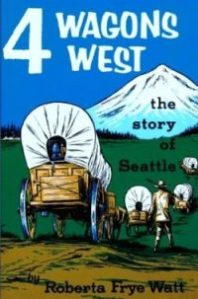
There is no resource list of the meanings of Seattle’s street names or how the street names were derived. Even the granddaughters of Seattle city founder Arthur Denny were left to speculate on his choices of the names for twelve downtown streets. The granddaughters wrote in their books, Four Wagons West and Pigtail Days in Old Seattle, about their memories of Arthur Denny, about early days in Seattle and what their best guess was as to the origin of the street names. Roberta Frye Watt wrote, “Why Mr. Denny named the streets in alliterative pairs, no one knows.” (page 107, Four Wagons West.)
Some street names are apparent in their derivation when honoring an early settler, such as Denny Way for the original homestead claim property of David Denny (Arthur’s younger brother) and Mercer Street for Thomas Mercer, an early, influential settler of Seattle. But for some other street names, such as Aloha Street, we may feel bewildered as we wonder, what is “Aloha” for?
In a previous post on this blog, I wrote about the founding of the City of Seattle and Arthur Denny’s naming of downtown streets. In this blog post we will consider some ways in which we might find out the reasons for other street names in Seattle outside of the downtown area.
In our first search, we will try to find the reasons for the name of Aloha Street. Our second search will be for Cleopatra Place NW in the Ballard neighborhood.
Pioneers and street names
Seattle’s early-arriving white settlers of the 1850s gave us the names of some major streets such as Denny Way, Mercer Street, Boren, Maynard and Yesler. Seattle history books as well as on-line sources such as HistoryLink have information on early settlers and their contributions to their adopted city of Seattle.
In 1852 Thomas Mercer was in the second group of white settlers to arrive in Seattle, about a year after the Denny family. Thomas Mercer’s wife had died on the wagon train journey from Illinois to Oregon. Leaving his four daughters temporarily in Salem, Oregon, Mercer came to Seattle to file a land claim and build a house for his family.
In 1859 Mercer married Hester Ward of Salem, and her brother Dillis B. Ward also came to Seattle at that time. The names of Mercer and Ward Streets are familiar ones in the Queen Anne area of Seattle, just north of Seattle Center.
Real estate developers and street names
In its early years Seattle grew slowly and there were many setbacks, such as economic depressions and the failure to obtain the terminal of a national railroad line in Seattle. Momentum grew in the 1880s, when real estate developers began to promote land developments. We can trace many street names to these early Seattle boosters.
On this blog I have written about the original street names in the Fremont neighborhood of Seattle. Some of the street names were those of the developers, such as the Blewetts who came from Fremont, Nebraska. Blewett Street which was named for them in 1888, was later changed to North 35th Street.
Some street names in Fremont which have not been changed are tributes to places “back home,” such as Aurora, Illinois, the hometown of Fremont investor E.C. Kilbourne, who named Aurora Avenue. Kilbourne and the investors group later changed some street names themselves, such as Pearl which was renamed Woodland Park Avenue, to indicate the route of the streetcar to Guy Phinney’s zoo and picnic grounds at Green Lake.
Another Fremont investor, Charles H. Baker, was from Chicago. He used the name of the Chicago suburb of Palatine as a plat name and a street name in Fremont. Charles Baker also owned plats of land in the Wedgwood neighborhood of northeast Seattle. He named one Oneida Gardens for Oneida, New York, his wife’s hometown.
Standardizing the Seattle street system
In the year 1895 the City of Seattle passed an ordinance to re-organize the city’s street system. Prior to that time, the word “street” was used, no matter whether the road ran east-west or north-south. The ordinance of 1895 ruled that thoroughfares which ran north-south would be called avenues, so “First Street” in downtown Seattle became First Avenue.
The other main purpose of the 1895 city ordinance was to standardize naming along the entire length of avenues and streets. Prior to 1895, each person who filed a plat (a section of land marked out with lots and streets) gave the streets whatever names they liked.
As the city grew, section by section, the street names were different in each section according to the names given by the original owner of that plat of land. A street might have four or more different names across its length as it passed through different plats.
Arthur Denny’s granddaughter Sophie Frye Bass wrote that “each man who opened an addition (plat) named the streets according to his fancy.… There were presidential streets and historic streets; streets named for shrubs and trees; streets for rivers and streets that showed loyalty to ideals such as Prohibition and Temperance…” (page 177, Pig-Tail Days in Old Seattle.)
A news article of 1895 implied that it was City Engineer R.H. Thomson who was assigned the task of untangling Seattle’s street system. He made the decision to give each street just one name across its entire length. For that reason, the downtown streets such as Cherry, Madison, Union, Pike and Pine extend eastward as far as the topography allows, to the shore of Lake Washington if possible.
Seattle historian Rob Ketcherside has listed the streets of Seattle in the 1895 ordinance in a searchable table. We see that “High Street,” for example, a street name used on Thomas Mercer’s first plat in the lower Queen Anne area, was changed to Aloha Street in 1895.
Aloha Street passes east-west through the city from Queen Anne Hill to Capitol Hill and Madison Park. There must have been a reason why R.H. Thomson chose this name over others and assigned it to the entire length of the street.
Aloha in Seattle?
Where did the name “Aloha Street” come from, and why was it chosen to supersede other street names as per the Street Renaming Ordinance of 1895? To find out where “Aloha Street” was first used, we can look at the plat maps across the length of Aloha Street.
The original homestead claim of Seattle pioneer Thomas Mercer is marked by Mercer Street, which today is the north boundary of Seattle Center. On his plat map filed in 1882 (below) we see that Mercer gave his name to the boundary street on the south, which adjoined the farm property of David Denny (today’s Seattle Center site.) On Mercer’s plat map, the next streets (going north) were named Thomas Street (today’s Roy Street), Valley, High (Aloha), Villard (Ward), and Prospect.

Thomas Mercer filed this plat map in 1882 for property just north of Seattle Center, between First to Third Avenues North.
We see that Aloha was not a street name used on Thomas Mercer’s plat of 1882, so we can assume that he was not the person who named this street. Later, the street ordinance of 1895 changed the name of High Street in Mercer’s plat, to Aloha.
Tracing Aloha Street along its eastward course, at the southeast corner of Lake Union we see that Aloha Street is only partial and has become a driveway on the campus of the Fred Hutchinson Cancer Research Center at 1100 Fairview Avenue.

Fred Hutchinson Cancer Research Center at 1100 Fairview North, where Aloha Street was marked on the original plat map in 1875.
The original plat map of this corner of Lake Union, present site of the Fred Hutchinson campus, was filed by David T. Denny (younger brother of Arthur Denny) and his wife Louisa Boren Denny. This land was not part of David and Louisa’s original homestead claim at what is now Seattle Center, but was land which they purchased later, for development.
The Denny’s South Lake Union plat map (below) was filed in 1875, a very early and optimistic land development, and was earlier than Thomas Mercer’s 1882 plat to the north of today’s Seattle Center. The streets in Denny’s plat at the southeast corner of Lake Union were Grange (Roy Street) Filbert (Valley), Aloha, and Fennisey (Ward Street).

David Denny and his wife Louisa Boren Denny filed this plat in 1875. At left is the shoreline of Lake Union along what is now Fairview Avenue.
Still puzzling over Aloha
From Lake Union eastward, we can trace Aloha Street across Capitol Hill as far east as the Madison Park neighborhood, where Aloha Street ends at the edge of the Arboretum at 28th Avenue East. The Capitol Hill and Madison Park plats were filed later than 1895 and have all of the current street names as were set by the street ordinance of 1895.
After looking at the original plat maps across the length of Aloha Street we conclude that David and Louisa Denny’s 1875 plat was the earliest, with “Aloha” the earliest street name. That may have been one reason for the name being preserved by the street renaming ordinance of 1895, plus its uniqueness: there was no other Aloha Street in Seattle.
The choice to preserve this name may have been arbitrary, with other original street names on the Denny’s plat (Grange, Filbert, and Fennesey) giving way to street names assigned in 1895 and still used today: Roy, Valley and Ward Streets.
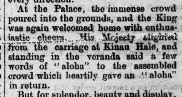
The Denny’s plat map of 1875 does not tell us why David and Louisa Denny chose the street names that they did, including “Aloha.” From earliest days, the Dennys knew that lumber was being shipped out from Seattle to San Francisco and as far as Hawaii, so our best guess is that they chose the word Aloha as a reference to Seattle’s trade connections.
Here’s a contributing thought from Seattle historian Rob Ketcherside, about the Hawaii news reported in 1875: “My guess: Due to King Kalakaua’s visit to San Francisco and Washington DC in early 1875. US-Hawaii treaty Jan 1875 created the sugar trade and allowed US Navy to use Pearl Harbor. Kalakaua 2nd king elected after death of Kamehameha V. Slogan “Hawaii for Hawaiians” (4/10/1875 Washington Standard newspaper here)
Another street name search: the mystery of Cleopatra
Here we will search for the origins of a street name “Cleopatra.” We will be able to find definite reasons for the name.
Cleopatra Place NW is in the Ballard neighborhood between 7th and 8th Avenues NW, a few blocks east of Ballard High School.
Cleopatra Place NW begins at NW 65th Street and continues north only as far as NW 73rd Street, a length of just three blocks. It may be that the decision was made to give this avenue a name, rather than a number, because it was only a short segment, and was between 7th and 8th Avenues NW.
Plats named Cleopatra Park, 1st and 2nd Additions, were filed in 1905 and 1907 before Ballard was officially annexed to Seattle in May 1907 and before Ballard’s street names were revised to be consistent with the Seattle street system.
Sometimes the “why” of a plat name is in the names and family backgrounds of the plat filers, as recorded in the legal description. The owners of the Cleopatra Park Addition were Archie J. Johnson and his wife Linnie Johnson. We see that even though the property was in Ballard in Seattle, their plat filing document was notarized in Corvallis, Oregon (notary seal in the lower right corner of the document below.)
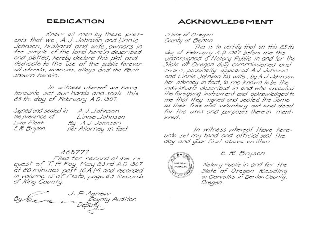
On the 1907 plat map for Cleopatra Park in Seattle’s Ballard neighborhood, in the lower right corner is the notary seal in Corvallis, Oregon.
Looking on the census of 1910 for this couple, we see the Johnsons recorded as living in Corvallis where Archie was the president of the Benton County State Bank. The census shows that Archie and Linnie Johnson had six children, all of whom were born in Oregon except their first child, daughter Cleopatra, who was born in Seattle in 1888.
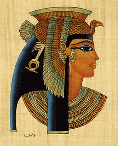
Cleopatra was a queen in Egypt.
The mystery of the Cleopatra Park Addition plat and the naming of Cleopatra Place NW has been solved by looking at notations on the plat map, and by researching the Johnson family via the census listings of the year 1910.
In the early years of their marriage in the 1880s, Archie and Linnie Johnson lived in Seattle, during which time their first child was born. They bought property in Ballard as an investment which they kept even after moving to Corvallis, Oregon.
When they thought that the time was right for the property to be developed, the Johnsons platted the land as the Cleopatra Park Additions (1 and 2) with a street layout and with lots for sale.
The only other mystery which we may not be able to solve, is why the Johnsons named their daughter Cleopatra (a queen in Egypt who ruled circa 30 BC).
The Johnson’s daughter did not seem to harbor hard feelings over her naming, however. The census of 1910 showed that Cleo, as she was called, was 21 years old and she was working as a stenographer at her father’s bank. The census of 1920 tells us that Cleo had married one of the other bank employees and the address listing for the young couple was near to Cleo’s parents, the Johnsons.
Ways and means of researching Seattle street names
In this article I have mentioned some of the possible ways to find out the reasons for some street names in Seattle. We can search out the history of Seattle’s early settlers and the names of plat filers, including the census where we can find family info.
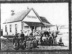
Wellsdale School, Oregon, in the 1890s, located near to Corvallis.
Another example of a Corvallis, Oregon resident who owned property in Seattle is Gordon V. Skelton. Living just a block or two away from Archie and Linnie Johnson, it is possible that the two families knew one another. Skelton was a professor at the college in Corvallis and he named his property in Seattle “Wellsdale.” This plat is in the Wedgwood neighborhood in northeast Seattle. In my article about the plat, I speculated that Professor Skelton was interested in having a land investment which he thought might have good prospects in Seattle, and that he derived the name Wellsdale from a community nearby to Corvallis, Oregon.
Reasons for Seattle street names can be attribution to the plat filer’s hometown, or family names, or names which were significant to them for political or historical reasons. We can’t always be sure, but we can have fun trying to figure out the sources of Seattle street names. Take a look at Writes of Way for more explorations of Seattle street names. This blog has a Street Name Index and you can check to see if your favorite street is mentioned.
Research resources:
Books:
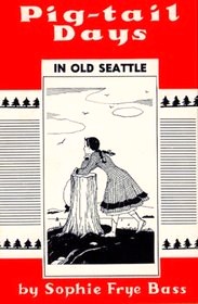 Four Wagons West, by Roberta Frye Watt, 1931, and Pig-Tail Days in Old Seattle, by Sophie Frye Bass, 1937. These two women were granddaughters of Arthur Denny. There are reserved copies of these books at the downtown Seattle Public Library’s 9th floor History Department or 10th floor Seattle Room. You can buy reprinted copies at the University Bookstore or at the MOHAI museum.
On-line sources:
HistoryLink essays – info on Seattle history.
King County Parcel Viewer – after putting in an address, click through to Property Detail. On the right margin of the page is a link to the plat map for that area.
 PaulDorpat.com Although Paul Dorpat is retired, his column is being maintained by others. An article of June 25, 2020, tells of the origins of Post Alley in downtown Seattle. Extending northward from Yesler Way, there was once an office of the Post-Intelligencer newspaper and a post office at that corner, so the naming could be from either of these. Use the “search” function on PaulDorpat.com to find references to other street names.
Queen Anne Historical Society webpage, for articles specifically about streets in that neighborhood.
Seattle Streets Renaming Searchable Table by Rob Ketcherside. Rob started with downtown Seattle streets and has added searchable tables for some other areas such as Ballard, Fremont and the Lake Union area.
Seattle Streets Renaming Ordinance of 1895 (Seattle Municipal Archives)
Writes of Way: blog about Seattle street names.





Interesting! Having just visited Seattle in November 2017, I’m thinking that choosing Aloha Street was just a plea for sunshine.
Thanks, Jason! I hope I brought out in this essay, my reasoning process of tracing Aloha Street and the history/property resources which are available, mostly on-line, which anyone can use.
Great work! I have seen Aloha Street so many times, and always wondered about it. It remains somewhat of a mystery, but I think you’re right, it must have been a nod to trade with Hawaii. I haven’t seen Cleopatra Street but I’ll look for it….
Thanks, I am glad you enjoyed puzzling over street names with me! This article was inspired by an inquiry from a reader as to Aloha Street. My conclusion was somewhat unsatisfying, so I added the info about Cleopatra Place NW to show a research inquiry with a definitive answer. One of my purposes in the article was to highlight the resources which are available, many of which are on-line such as the census.
Curious how the name Republican Street was decided on. Do you have any clue?
I found this interesting being a history nerd.
The person who filed the plat (map of streets and names) was the one who assigned the original street names. On pages 356-357 of the book Four Wagons West, it says that David Denny was the one who filed the plat which contained some of the street names still used, such as Harrison and Republican. He named streets according to values he held, such as Temperance. The Dennys lived in the era when the Republican Party was first formed (1854) to oppose the spread of slavery into western states. Abraham Lincoln was elected in 1860 as the first president from the Republican party.
Similar to the example of Aloha Street that I used in this article, Republican Street now spans the city east-west. Its name was retained but other street names in David Denny’s plat have been replaced. To the north of Republican Street is Mercer, and that was the boundary line with the land claim of Thomas Mercer.
Pingback: Aloha Street ~ Writes of Way