
Sand Point map of 1894
There was not yet a road called Sand Point Way NE when the first commercial activities began at about NE 70th Street on Lake Washington. In the 1880s Edward F. Lee had a boat-building shop there, and Osborn M. Merritt had a shingle mill. Merritt was from Pontiac, Michigan, and the name he chose for his business, Pontiac Shingle Mill, “caught on” as names sometimes do, as a name for the area.
The next business to open was named Pontiac Brick Company, a brickmaking plant owned by the investors group of Thomas Burke, Morgan J. Carkeek and Corliss P. Stone.
With fortuitous timing, the brick plant at Pontiac was set up and ready to operate just before Seattle’s Great Fire of June 6, 1889. The Fire burned a wide swath of downtown Seattle business blocks which had almost all wood-frame buildings. In the rebuilding after the Fire it was ordered that new structures must be built of brick and stone. The Pontiac Brick Company roared into production to make bricks for new buildings in Seattle.
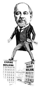
Judge Thomas Burke was an attorney, real estate investor and civic activist in Seattle.
The Pontiac Brick Company was sited for access to clay for making bricks and it was also alongside the tracks of the new Seattle, Lake Shore & Eastern Railroad (SLS&E) which had just been put through in 1887.
Thomas Burke and his railroad co-developer Daniel Gilman planned the railroad line for this very purpose, to access sites of natural resources and commercial production. The SLS&E route has been preserved as today’s Burke-Gilman Trail.
Pontiac at Lake Washington had a lot of activity for a few years, most especially during the years of the brick plant. Mr. Lee of the boat building shop served as postmaster for the mail which came by train. There was a Pontiac School for the community’s children from 1908-1911. The school closed as there was not much activity in the area any more after that.
This blog post will tell how Sand Point Way NE developed as an arterial road because of the Naval Air Station at about NE 74th Street on Lake Washington.
How it became known as Sand Point

Sand Point shoreline
Despite early references to a Pontiac Road, the name gradually faded from use except for the designation of Pontiac Bay. From the 1850s, Seattle’s early white settlers called the area Sand Point because that was an exact translation of the name the local native Americans used.
In general, native Americans of Seattle would use place identifiers assigned from the point of view of the water, looking toward the land. They knew Sand Point to be a coastal peninsula (a point of land sticking out into the water) with a flat, easily accessible sandy beach. It was a good place to pull a canoe up onto the beach and access freshwater resources of the little streams which flowed into the bay.
The struggle for roads
The white settlers of Seattle were not planning to travel around by canoe as the native peoples did. Seattle’s early settlers were interested in extraction of natural resources like the clay used for brick-making at the Pontiac plant. Roads and railways would be needed to bring heavy-to-haul products such as bricks, coal and lumber to market. Sand Point was very difficult to reach by land, and it was a long time before roads were developed there. In the meantime, Seattle’s own home-grown railroad, the Seattle, Lake Shore & Eastern, was built parallel to the shore of Lake Washington.

Walking along the train tracks in northeast Seattle. Seattle Engineering Dept #3406 photo of 1929.
There is a sense in which the railroad itself created a road. The railroad right-of-way was graded wide and flat, with trees removed so that roots or branches would not obstruct the line.
From the creation of the SLS&E Railroad in 1887, a person could walk alongside the tracks all the way from Bothell to Seattle. However it was not possible to drive a horse & wagon alongside the railroad tracks nor was it possible to drive a car there. The pressures created by the rise of automobile use in the early 1900s caused even more emphasis on road-building.
Much of Seattle’s early legislation and taxation had to do with the need of roads. Where there was no water transport available, farmers wanted roads for bringing products to market via horse and wagon. Farmers in Bothell, for example, located about ten miles to the northeast of Seattle, could send market products down Lake Washington by boat, but a transfer was then required to wagons on land. They didn’t want to use the railroad, either, because they didn’t want to pay freight charges. This was the motivation behind building the Gerhard Erickson Road in 1913, which was east of/parallel to today’s Lake City Way/Bothell Way. This road made it possible to travel from Bothell to Seattle by car.
The Naval Air Station at Sand Point

Thomas Mercer
1813-1898
One of the Seattle settlers’ earliest community events was a Fourth of July picnic in 1854, held at Lake Union near downtown Seattle. At the picnic Thomas Mercer proposed the name Lake Union because he saw it would be possible to unite three bodies of water by creating a canal from Lake Washington through Lake Union and westward to Puget Sound.
It took another sixty years for the vision of a ship canal to be realized, but in the meantime Seattleites knew of the value of a freshwater harbor for boats in Lake Washington, and they had an interest in offering Sand Point as the site of a naval base. Ultimately Sand Point became an airplane base more than one for ships.
In the 1920s King County began trying to give the Sand Point site to the US Navy. The Navy was not authorized to accept it directly, but had to wait for the authorization to be approved by Congress. In the meantime the Navy did begin flights from Sand Point in 1924, including the first aerial circumnavigation of the globe. In 1927 Congress finally approved money to begin developing the naval air station at Sand Point.
Sand Point Way NE outside of the Seattle City Limits

A 1938 Seattle Engineering Department map of the city showing the annexations dates of different neighborhoods. A “jog” can be seen at the northeast corner where the City Limits were at NE 65th Street as of 1910. Map from the Seattle Municipal Archives Record Series 2616-03.
Historians have speculated as to why northeast Seattle got left out of the Seattle City Limits as of the year 1910. Other north Seattle neighborhoods such as Green Lake were inside the City Limits by or before 1910. Reasons may be because Green Lake was developed with houses beginning in the 1880s and could be reached from downtown via streetcar line.
AS of 1910 the north Seattle City Limit boundary went across 85th Street to include Green Lake, then took a jog down to NE 65th Street. This was enough to include the University District, Ravenna and Laurelhurst.
Northeast of those neighborhoods, as of 1910 the population was sparse. It was not until 1954 that the City Limit went all the way up to NE 145th Street, to include the present Sand Point, Wedgwood, Meadowbrook and Lake City.
It is interesting to note that early references to a “Pontiac Road” did not “stick” and that the shoreline area gradually became known as Sand Point. One other Pontiac reference was to a plat in Wedgwood. In 1890, a section of land from NE 85th to 95th Streets, east side of 35th Ave NE, was named the Pontiac Addition to Seattle. Thus the (future) Wedgwood neighborhood might also have been named Pontiac, but this is another example of how neighborhood names evolve unpredictably.
Naming and building Sand Point Way NE
In 1927 Seattle City Council passed a street-name ordinance for Sand Point Way NE — but only as far as their line of authority, which was the northeast Seattle City Limits at NE 65th Street. City Council knew that just a few blocks farther north, at NE 70th to 75th Streets, the road was already being referred to as Sand Point Way because the naval base was officially there by that year.

Sand Point Way NE, outlined in blue at right, extends northward as far as NE 125th Street.
In 1929 Seattle City Council began talking about paving the road. A way was worked out with King County paying part of the cost, plus assessments of property owners along the route. This did not go through without protest, and the year 1930 was spent in the process of finalizing the plan and making cost estimates.
In 1931 the project was put out to bid and Moceri Brothers, Inc., won the contract to pave Sand Point Way. From the news article it may have meant to indicate just the portion paid for by Seattle.
Other mentions of the paving project indicated that paving continued north of the Naval Air Station’s entrance at NE 74th Street on Sand Point Way. Contracts continued to be awarded for paving the cross-street connections to Sand Point Way, such as NE 95th Street.
The Naval Air Station 1920 to 1970
The growth of the Naval Air Station at Sand Point generated a lot of excitement in northeast Seattle because people believed the NAS would help the economy. Jobs were created at the base and the presence of the base would also stimulate growth of nearby businesses along Sand Point Way. One of the first to establish a business was Carl Dooley, who opened Dooley’s Restaurant in 1926, directly across from the entrance gate to NAS.

Looking southward along Sand Point Way NE in 1960, we see the entrance to the Naval Air Station and Dooley’s at right. Seattle Municipal Archives photo.
The Naval Air Station grew slowly in the 1920s and probably for that reason, at first there were not a lot of commercial businesses established nearby along Sand Point Way NE. The base really grew beginning in 1939 with federal money to improve the site with more buildings to accommodate more servicemen and aircraft. After the USA got involved in World War Two in 1941, the NAS at Sand Point had at least 8,000 civilian and military personnel.

Gate of the Naval Air Station with the World Flight Monument’s winged tower
The NAS stayed active in the period from the end of World War Two in 1945, through the Korean Conflict in the 1950s. All flight activities at the base ended on June 30, 1970. In the 1970s the runways were demolished to begin to restore the fields to a more park-like condition. In May 1977 the base and its fields were officially renamed in honor of Washington State Senator Warren G. Magnuson and is called Magnuson Park today. In the year 2011 the former Naval Air Station buildings & grounds were nominated as a Historic District in Seattle and will be preserved.
Along the road today
From the intersection of Union Bay Place NE near University Village, out as far as today’s Magnuson Park, Sand Point Way NE is a very wide arterial. Then suddenly, north of the NE 74th Street gate to the former NAS, Sand Point Way narrows and becomes a winding, country road of only one lane in each direction. On this northern portion of Sand Point Way NE we can still get a feel for the rural community of the 1920s where there were a few scattered houses, some small grocery stores and gas stations along the road.

A hamburger place built in 1941 at 7321 Sand Point Way NE right across from the Naval Air Station.
Sources:

P:rior to 1926, maps showed Carkeek Park at Sand Point. After the naval air station was created, another site was found, the present Carkeek Park on Puget Sound.
City Limits: The north Seattle City Limits were finally set at 145th Street in 1954. It was a gradual process through the 1940s and 1950s when election precincts voted themselves into the City. The “directional designations” changed in 1961 so that East 75th Street, for example, became NE 75th Street. At the end of my blog article about Election Districts is a source list to the dates and a map of precincts. Info about the inclusion of separate cities, such as Ravenna, is in this article about annexations. Info about the system of Seattle street names is in this article.
Street name of Sand Point Way NE: was approved in City Ordinance #52478 of February 1927, when the City of Seattle named the road as a continuous single entity up to 65th Street, which was the City Limits.
World Flight Monument: Seattle sculptor Victor Alonzo Lewis created this monument in 1924 in commemoration of the first aerial circumnavigation of the globe. It was said that the flight was the event which finally convinced Congress to allocate money for the naval air station.
HistoryLink Essays:

Wing detail of the World Flight Monument at the gate of the former Naval Air Station.
#364 “First aerial circumnavigation of the globe, April 6 to September 28, 1924,” by Walt Crowley, 1998. The World Flight Monument at the gate of NAS commemorates this achievement.
#1445 “Seattle residents celebrate Independence Day on July 4, 1854,” by Walt Crowley, 1999.
#2306 “Lee Shipyard, First business on Sand Point opens about 1886,” by Greg Lange, 2000.
#2217 “Pontiac Brick & Tile Company opened on January 2, 1889,” by Greg Lange, 2000. The Pontiac Post Office opened on January 18, 1890. (Essay #23388)
#2303 “King County transfers 413 Sand Point acres to the US Navy on March 8, 1926,” by Greg Lange, 2000.
#2487 “Sand Point: the Early Years 1850-1920,” by Greg Lange, 2000.
#2249 “Sand Point Naval Air Station: 1920-1970,” by David Wilma, 2000.
Newspaper references:

Plaque on the World Flight Monument commemorating the first aerial circumnavigation of the globe, April 6 to September 28, 1924. The planes took off from Sand Point.
1929 paving discussion: “Sand Point Highway Issue Up December 9,” Seattle Daily Times, November 13, 1929, page 2. “The City Council will resume consideration on December 9 of plans for paving Sand Point Way to provide better connection between the Naval Air Station and the city.”
1930 awarding the paving contracts: “Bids Amounting to $385,911 are Awarded by City,” Seattle Daily Times, February 28, 1930, page 2. “The contract for paving Sand Point Way to give the Naval Air Station a connection with Seattle’s arterial highway system, was awarded to S.A. Moceri, Inc., on a bid of $164,910.”
1930 approval of the paving costs: “$196,357 Sand Point Paving Roll Comes Up Tomorrow, “ Seattle Sunday Times, November 2, 1930, page 14. “An assessment roll apportioning the cost of paving Sand Point Way inside the city limits — a total of $196,346 is ready to come before the City Council tomorrow afternoon in preparation for final debate. This new highway, built jointly by private property holders, the City of Seattle and King County, connects the Seattle Naval Air Station, Sand Point and the intervening district with the county, city and state highway system.”
1931 Fiorito Brothers contract to pave NE 95th Street: Along with paving Sand Point Way NE, work began to connect cross-streets such as NE 95th which goes all the way from Lake City Way NE to Sand Point Way NE. “King County paving contract for NE 95th Street awarded to Fiorito Brothers,” Seattle Daily Times, March 17, 1931, page 15.

Naval Air Station photo by Mark Knoke, 2014.
