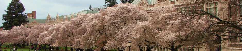

View Ridge map courtesy of HistoryLink.org
The years of World War Two (1941-1945) marked a major turning point in the development of neighborhoods in northeast Seattle. Up until that time northeast Seattle had been very rural. There were some real estate investors and builders of houses before the 1940s but northeast Seattle’s boom years of housing growth did not happen until after 1945.
As of the 1940s, neighborhoods like View Ridge and Wedgwood were unnamed and still had vast areas of vacant land. These neighborhoods acquired their identities during the rapid-growth years of the 1940s and 1950s.
This blog post will tell how a pasture became a playfield in northeast Seattle, as the area transformed from rural to urban after World War Two. View Ridge Playfield at 4408 NE 70th Street, is a field where cows once grazed.
Land speculators look to the northeast in 1909
The Alaska-Yukon-Pacific Exposition was held on the campus of the University of Washington in 1909.
A world’s fair event in 1909 first began to bring attention to northeast Seattle. The event, called the Alaska-Yukon-Pacific Exposition, was held on the campus of the University of Washington which was still undeveloped at that time.
The AYPE caused land speculators to look to the northeast as the possible next growth area of Seattle. The well-known Crawford & Conover real estate company filed a plat map called Exposition Heights to the east of the university along today’s NE 45th Street, east of today’s University Village shopping center.
Growth was very slow in Exposition Heights during early years, due to lack of roads and lack of utilities such as water and electric lines. By the 1920s, NE 45th Street was developing more as it proceeded eastward through the Union Bay Place intersection and connected with Sand Point Way NE.
Morningside in the neighborhood
Another real estate group filed a plat called Morningside Heights at NE 95th Street, bordered by 25th & 35th Avenues NE. In the 1920s this was the first organized cluster of houses in what would later become the Wedgwood neighborhood. Morningside was a name which took hold for some businesses in the area and today there is still a Morningside Market, built in 1926, on 35th Ave NE.
Another business which decided to call itself Morningside in the 1920s was a dairy operation at the present site of View Ridge Playfield, 4408 NE 70th Street. Morningside Dairy was operated by the Hardow family for approximately twenty years.

The Hardow house in 1926
The Hardow family’s immigrant story
Lars Peter Hardow, his wife Ingar and their three children immigrated from Sweden to the USA in 1869. They had intended to farm in Iowa but only a few months after their arrival, Ingar died of typhoid. Left alone with three small children, Lars accepted the offer of his sister Johanna to come to Minnesota, where she would help the family.
About ten years later Lars remarried and had six more children with his second wife Mary. By the 1920s, five of the Hardow children were living in Seattle.

Lars Hardow with his second wife Mary & family.
From Minnesota to Seattle

Franz Hardow
One of the Hardow sons, Franz, married Anna Gerrels in Minnesota in 1921. Anna was the daughter of German immigrants.
Franz & Anna set out to write the next chapter in their immigrant family story by moving out to Seattle. Some of Franz’ siblings had preceded him and may have enticed Franz with the opportunities which lay in Seattle.
Franz decided to meld his rural background with newer opportunities in Seattle, so he established the Morningside Dairy business with delivery by truck instead of by horse-drawn wagon.
The Hardow’s land lease
The Hardows leased their dairy farmland from the Washington State Office of the Commissioner of Public Lands. On the Public Lands plat map, the Hardow’s farm was at sections 3, 10, 15, and 22, bordered by NE 75th Street at the top, NE 70th Street on the south side of their pasture, and 45th Ave NE along the east side of their farm.

The Public Lands Commission leased some of the land in the plat, and sold some sections, tending to sell around the perimeter because no development had been done and there were no roads inside of the blocks.
Today’s Wedgwood Safeway is in the top left corner of the plat map at 75th & 35th.
East of Safeway, the Medohart plat was land that had been purchased in 1919 from sections 5 and 8 of the Public Lands. The residents of Medohart could only access their houses from NE 75th Street because no sidestreets had been put through.
The Public Lands plat retained this rural aspect until after World War Two when developers like Albert Balch bought more sections and put in streets. By the late 1940s, the Hardow’s land was surrounded by housing plats called Albert Balch’s View Ridge Number 13, Number 14, etc.
The Hardows and their neighbors

The Gebaroff house has been remodelled but still stands today at 7003 40th Ave NE.
In the 1920s in northeast Seattle the Hardows found themselves in a community of immigrants and descendants of immigrants like themselves.
At the intersection of NE 70th Street & 40th Ave NE, Andrew Gebaroff from Bulgaria was a schoolteacher and had a side-business of growing flowers. His homesite is shown here at the northwest corner of the intersection, with 40th Ave NE the line going up to the top of this aerial photo of 1947.
To the north of the Gebaroff house lived Mr. Girolamo, an Italian immigrant who was growing fruits and vegetables for market. We can see the fields of the Gebaroff and Girolamo families on the west side of 40th Ave NE.

Aerial photo of 1947. The line going up to the top of the photo is 40th Ave NE. The east-west line is NE 70th Street. Hardow dairy property is in the upper right quadrant.
The Hardow’s Morningside Dairy was on NE 70th Street (the line going left-right on the aerial photo.) The Hardow’s pasture is shown here as the upper quadrant of the photo, on the east side of 40th Ave NE.
To the east of the Hardows (out of frame of this photo), bordering 45th Ave NE was a hillside where the Bilodeau family from Canada and several Japanese families were growing fruits and vegetables for market. As of 1944 this hilltop would become the site of View Ridge Elementary School.

Home of William & Mary Rose at 6810 40th Ave NE
In the 1920s the Hardows and their neighbors drove cars and trucks because there was no other good way to get around northeast Seattle, which lacked any public transportation system such as bus or streetcar.
One of the Hardow’s neighbors was William Rose, who drove to work each day for his job as a chef in a downtown restaurant.
William Rose was a German immigrant who had lived in St. Louis, Missouri, before coming out to Seattle. His wife Mary, an immigrant from Scotland, became fast friends with Anna Hardow.
Neighbors helped one another such as when Anna Hardow had to make an emergency visit back to Minnesota to visit family. It was during the school year, so Anna wanted her daughter Frances, age eight, to stay home and attend school. Mary Rose took Frances to her house for the duration. The Rose’s daughter Marion was four years older than Frances and the two girls walked to school together, to Bryant School on NE 60th Street.
In the 1940 family-and-friends photo below, Mary Rose is second from left, then Franz Hardow, and Marion Rose on the other side of Franz. Next man is William Rose, with Anna Hardow next to him (second from right). The people on either end of the photo are Franz’s brother Fred (right side of photo), and his wife (left side of photo).

The Hardow family in 1940 with relatives and neighbors.
Entering the 1940s in northeast Seattle

The Hardow cows at pasture. To the east we see the hillside where View Ridge School was later built.
The World War Two years, 1941 to 1945, were difficult for everyone with war fears, rationing and scarcity of consumer goods.
Franz Hardow continued delivering milk and he could also offer eggs from the Hardow’s abundantly-producing chickens, which was an additional source of income. Anna kept track of the sales and filed the required sales tax information.
In a letter she wrote to family members back in Minnesota in 1943, Anna Hardow joked that she had acquired a lot of “good friends.” She had become popular with neighbor ladies because Anna always had enough coffee available for hosting gatherings. Anna was the only one of the Hardows who drank coffee, a rationed item, so her ration was more than enough.

Frances Hardow in Roosevelt High School graduation gown in 1944, at home, showing a Cedar Vale house on the north side of the block.
During the war years, people made sacrifices to support the war effort. They wanted to be patriotic, so they accepted some government decrees such as rationing of foodstuffs like sugar and coffee, and rationing of gasoline, but that didn’t mean it was easy.
For the Hardow family the next “government” event which greatly impacted them, was the taking of land at the north end of their block. Since they were leasing, they didn’t have any say in this, plus the wartime measures cited for the Seattle Housing Authority to build emergency housing called Cedar Vale.
Like Shearwater on the north side of NE 75th Street, the Cedar Vale housing on the south side of NE 75th Street was at first intended for war industry workers, civilians who might be working at places like the shipyard, Boeing or the Naval Air Station at Sand Point.

The Hardow’s house can be seen at left, and Cedar Vale at right, in this 1950 view of the fields. We are looking westward across 45th Ave NE in the foreground. Seattle Municipal Archives photo #30435.
After World War Two
After the war ended in 1945, the 1940s and 1950s were years of rapid change in northeast Seattle.
The population of Seattle increased as soldiers came home from war, married and started families. There was a rush to build enough schools to accommodate all the children.
Northeast Seattle neighborhoods had begun to coalesce under new names so when a new school opened near the Hardows in 1944, it was named View Ridge.

View Ridge School construction in 1948. The portable classrooms are in the background.
View Ridge School opened in 1944 with four portable classrooms only (no permanent building yet), and by 1946 there were twelve portables. The permanent View Ridge school building opened in 1948 but two portables were still needed, and in 1950 there were six portables outside the building. These were the Baby Boom years of growth in Seattle after World War Two.
Becoming View Ridge
In the 1930s two young radio salesmen left their jobs and ventured into real estate. Ralph Jones & Albert Balch successfully began building a cluster of houses on the high ridge of 50th Ave NE, looking eastward down to Sand Point on Lake Washington. Jones & Balch named their development View Ridge and it became the name of the neighborhood.
After the war, the Cedar Vale housing at the north end of the Hardow’s block was acquired by Albert Balch. He gradually had the Cedar Vale houses moved off of the site and he built new houses there in a plat called Albert Balch’s View Ridge Number 17.

In this 1955 view of View Ridge playfield, 45th Ave NE is in the foreground. At right we see that the Cedar Vale war housing is gone. New houses are being built by developer Albert Balch. Seattle Municipal Archives photo #30439.
The end of the Hardow’s Morningside Dairy
One of the most difficult post-war changes for the Hardow family was that in 1945, their street came into the City Limits of Seattle. Along with all the other changes taking place in the 1940s, this meant that the Hardows no longer lived in an unincorporated, rural area where they could keep cows. The Hardows closed the dairy and moved over to a house on 40th Ave NE. Franz had to find other employment, so he began working with his sister Clara’s husband Jack Summer, a building contractor.
In the 1950s the Hardows moved out to today’s Shoreline (unincorporated at that time) where they could continue some aspects of the semi-rural lifestyle that they preferred – but no more cows.
Becoming View Ridge Playfield
After the war, community activists in northeast Seattle recognized that advocacy was needed to preserve space for parks and playgrounds. There was still a vast amount of undeveloped land in northeast Seattle which could potentially be gobbled up by developers like Balch, unless communities took action to preserve open space.
The Hawthorne Hills Community Club first took action in 1946 to petition the City for the site of Hardow’s Morningside Dairy be set aside for a playfield. It was in an excellent location on the block next to View Ridge School, bordered by arterials and centrally located in the neighborhood.

In this photo of 1950, the photographer is standing on the steps leading up to the View Ridge School. We are looking west out over 45th Ave NE and we see the grading machines working on leveling View Ridge Playfield. Cedar Vale wartime housing is still in place at right. Seattle Municipal Archives photo #30437.
Over the next two years the City solidified this action and officially gave the playfield project the go-ahead in 1948. From the start, the site was called View Ridge Playfield as the name “View Ridge” had become the identifier of the neighborhood.
Today’s playfield is the heart of the View Ridge community, and its well-being is overseen by the local community council. Over the years the site has been upgraded and the play structures will be redone again in 2024.

Playground in a shaded area of View Ridge Playfield closest to NE 70th Street. Photo by Valarie.
Sources and Links

Baseball diamond and backstop in the northeast corner of View Ridge Playfield. Photo by Valarie.
THANK YOU SO MUCH to the Hardow family who have shared their story.
Find A Grave: This wonderful free resource is available to document families. Starting with Hardow partriarch Lars Peter Hardow, there’s a convenient list of his children including Franz Hardow of this blog article.
City Limits: The north Seattle City Limits were finally set at 145th Street in 1954. It was a gradual process through the 1940s and 1950s when election precincts voted themselves into the City. The “directional designations” changed in 1961 so that East 75th Street, for example, became NE 75th Street. At the end of my blog article about Election Districts is a source list to the dates and a map of precincts. Info about the inclusion of separate cities, such as Ravenna, is in this article about annexations. Info about the system of Seattle street names is in this article.

Field house at View Ridge Playfield. Photo by Valarie.
“Judge OKs Assessments for View Ridge Playfield,” Seattle Post Intelligencer June 26, 1948, page 3.
Seattle Neighborhoods: View Ridge – Thumbnail History.” HistoryLink Essay #3460, by David Wilma, 2001.
View Ridge Playfield — Seattle Parks – Don Sherwood History Sheets.
View Ridge Community Council (Facebook page)
View Ridge Playfield Play Area Renovation – scheduled for 2024.
View Ridge School (1944), 7047 50th Ave NE, Seattle School histories.

View Ridge Playfield drawn by Don Sherwood, Park Histories.
