
Meadowbrook Pond is located on the east side of 35th Ave NE at NE 107th Street.
The Thornton Creek Watershed is a system of big and small streams which drain the region of northeast Seattle, with the final outflow into Lake Washington at Matthews Beach, at about NE 93rd Street.
The watershed has two main branches, one originating near Ronald Bog Park (at NE 175th Street & Meridian Ave North) and the other from a wetland near North Seattle Community College (100th & Meridian.)
At this writing, no documentation has been discovered, as to the source of the name “Thornton Creek.” If it was an honorary name, Thornton Creek might have been named for John Thornton, an early resident of Washington Territory who served in the territorial legislature. John Thornton lived in the Port Townsend area.
The two branches of Thornton Creek are called the North Fork and South Fork, and they combine at Meadowbrook Pond on the east side of 35th Ave NE at NE 107th Street. The area is called The Confluence because the two Thornton Creek branches join here. The Meadowbrook Pond, first developed by Seattle Public Utilities at The Confluence in 1996-1998, has become a successful site for collecting, slowing and filtering the water before its final flow into Lake Washington.
Land clearing leads to excessive water run-off

The Fischer farmhouse at 3017 NE 105th Street was completed in about 1913. In earlier years the Fischers lived at about 103rd & 32nd Ave NE.
The Becker and Fischer families who came to Seattle in the 1870s and 1880s were Meadowbrook’s first settlers. They began to clear the land for farming, cutting down all the trees and even digging out each stump. Their goal, besides making use of the timber for firewood and for building, was to clear the land so that it could be thoroughly cultivated, every square foot being used for crops or pasturage.
Unfortunately, those early settlers didn’t realize how their actions would ultimately affect the environment. Total clearing of the land resulted in soil being washed away for lack of tree-roots to hold it and to absorb rainwater. Soil washed into the streams, silting them and harming the conditions for fish.
Population and pavement cause problems for the stream system
By the 1920s and 1930s northeast Seattle had really begun to grow, with houses and roads going in everywhere. Mr. and Mrs. Joe Nessel moved from the University District to Meadowbrook in 1921 and built a house at about NE 102nd Street, on the western hillside above the new Victory Way highway (Lake City Way NE.)
As a young boy the Nessel’s son Clifford went down to see the construction and development taking place at the Naval Air Station in the period 1926-1930. The arterial Sand Point Way NE was being built, and men were putting in culverts to cause the various streams to pass under the road. Clifford realized that the road grading and inadequate piping would inhibit the travel of fish upstream. Sure enough, within two years of development along the Lake Washington shoreline and paved roads, salmon were no longer found in local streams.
Meadowbrook Golf Course

In this 1930s photo of Meadowbrook Golf Course we are standing with our backs to the hill at NE 105th Street, looking north to the present site of Nathan Hale High School. The top left of the photo is the corner of NE 110th Street and 30th Ave NE. Here we see excavation contractor John MacLean trying to improve drainage on the golf course by dredging a channel at the base of the hill, using a horse-drawn scoop shovel. Photo courtesy of his daughter Jessie Thomson.
By the 1930s August Fischer had started selling some of his former farmland, but in the valley between NE 105th to 110th Streets the soil was too soggy for houses to be built there. Instead, the entire tract was bought to be used as a golf course which opened in 1932, named Meadowbrook because it was a cleared-meadow site and still had a stream running through it. In the 1930s photo above, we see excavation contractor John MacLean working to create a channel for water at the south edge of the golf course, at the base of the hill at NE 105th Street.
Gradually over many years time, the name Meadowbrook caught on in general usage as the name of the neighborhood. The Burns and Tachell families operated Meadowbrook Golf Course until 1960 when the land was taken by “eminent domain” by Seattle Public Schools for the site of Nathan Hale High School.

The south branch of Thornton Creek runs parallel to the Nathan Hale High School building. Bridges link the student parking lot to the building.
Environmental problems didn’t end when Nathan Hale High School opened in 1963. The stream, which is the south branch of Thornton Creek, was preserved above-ground by rechanneling it and causing it to run parallel to the school building. But the playing fields to the south of the school, between the hillside and the stream, continued to be soggy. T
Soon after the school opened, its newly-installed tennis courts sank, and the baseball fields were often too wet to use. It was clear that there were more sources of water than just the main stream which had been channeled and set alongside the school building.
More roads, houses and a freeway impede the flow of water, leading to flooding

Someone thought it would be a good idea (???) to build the North Precinct Police Station at N. 103rd Street and Meridian Ave N., where there is standing water from a spring on the site, year-round. Photo by Valarie.
From the 1920s when roads such as Lake City Way NE and Sand Point Way NE were first paved, until the 1990s when most vacant lots in Meadowbrook had been built-upon, the creek system received little or no maintenance or attention. Flooding got worse as the amount of impervious surface increased and in many places, businesses and other private owners put the stream through drainage pipes and built over it.
Some of the worst environmental damage was caused by the building of the Interstate 5 freeway, completed in the early 1960s, a vast concrete barrier which cut off the eastward flow of the South Fork streams toward Lake Washington. Today water can be seen pooling at the site of Seattle’s North Precinct Police Station on Meridian Ave. North on the west side of the freeway. The station, inexplicably built at the lowest point in the road and adjacent to a spring, regularly has water in the basement because the water is cut off by the freeway and cannot drain fast enough toward its natural eastward direction.
For the building of private homes in Seattle, until recent years there were no environmental restrictions to prevent houses from being crowded in next to creeks. One of the problems was, and continues to be, that the Thornton Creek system is eighteen miles long and covers twelve square miles in different jurisdictions. In earlier years the creek was in part of unincorporated King County, then Shoreline and into the City of Seattle. (See: watershed map at the end of this article.)
Creek and drainage efforts begin in the 1990s

In 1997 the Meadowbrook Community Center was completed at 10517 35th Ave NE, adjacent to the swimming pool building.
In 1992 Janine Van Sanden, a landscaper in Meadowbrook, and landscape architect Peggy Gaynor obtained one of Seattle’s first neighborhood matching grants to create a drainage area, which they called a creeklet, along the base of the Meadowbrook Hill parallel to NE 105th Street. The creeklet is in the same channel as pictured in the 1930s drainage photo on the golf course!
Over sixty years’ time the water was still winning, despite efforts to use the fields for everything from farming to a golf course to high school baseball and tennis. The creeklet project turned into a series of small ponds, partly spring-fed. Because surface area was allowed for the water to go into side-channels, it has helped to reduce flooding and it allows sediment to settle.
After the completion of the new Meadowbrook Community Center building in January 1997, a second matching grant was used to create another creeklet. It runs north and south, next to the sidewalk of the community center building, and connects to the main stream which runs past the high school. This provides drainage from the hillside and fields through the creeklet into the main stream.

Meadowbrook Pond has pathways, bridges, outdoor artwork and viewing platforms. Photo by Valarie.
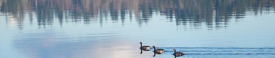
The South Fork of Thornton Creek with all its contributing creeklets flows eastward under 35th Ave NE and into the Meadowbrook Pond at about NE 107th Street. It is joined there by the North Fork of Thornton Creek, creating the area called The Confluence.
The Seattle Engineering Department began construction June 17, 1996 on the Meadowbrook Detention and Sedimentation Pond, designed to help filter the water at The Confluence of Thornton Creek so that less sediment will go down to Matthews Beach. The Pond Project was also intended to provide storage for stormwater, help prevent flooding, and create habitat for wildlife.
The Thornton Creek Water Quality Channel at Northgate

Looking east across the Thornton Creek Water Quality Channel at Northgate, we see the pathways and viewing areas around the channel cut diagonally through the block. The buildings on the perimeter are: left: Thornton Place Apartments; center: Aljoya retirement community; right: Group Health building on the corner of 5th Ave NE and NE 100th Street. Photo by Valarie.
Since 1992 when community activists formed the Thornton Creek Alliance, TCA has worked effectively in conjunction with city departments such as Seattle Public Utilities to help monitor and maintain area creeks. A long struggle at Northgate between developers, neighborhood stakeholders and environmentalists such as TCA finally ended successfully. An open channel was created, called “daylighting the creek,” at the headwaters of the South Fork of Thornton Creek at what used to be a vast parking lot along 5th Ave NE, south of Northgate Mall.

Falling Water
Where there formerly was a paved parking lot, now the filtration of pollutants and sediments by letting water seep through soil and plantings in the channel, has proven to be highly effective at cleaning the water. This successful site at Northgate called The Thornton Creek Water Quality Channel contributes directly to the health of Meadowbrook’s creeks which are farther downstream. In addition to the environmental benefits, a delightful open space has been created at the channel with views of the water, plantings, terraces and art installations. Here is a link to info about the public art installations at the site.
Flood control work continues in Meadowbrook

The Meadowbrook branch of Thornton Creek sometimes overflowed into the Nathan Hale High School parking lot (in background.)
Efforts to prevent flooding have not always been successful. During the 2012-2013 school year the creek overflowed its banks onto the parking lot at Nathan Hale High School. The most recent severe flooding of houses in Meadowbrook occurred in 2007. Water covered the road on 35th Ave NE at the site of Meadowbrook Pond, and houses downstream were flooded to a depth of more than two feet in places.
Over the period from 2012 to the present, Seattle Public Utilities has continued to do maintenance and improvement work at Meadowbrook Pond. As originally designed the Pond worked well to collect sediment and prevent it going farther downstream, but that meant that the pond was rapidly filling up with sediment. The Pond had to be maintained, including vacuuming sediment and dredging the pond every few years. Beginning in 2012 Seattle Public Utilities began a series of additional improvements to increase the Pond’s capacity to hold water and increase the filtration so that less vacuuming of sediment would be needed.
In the summer of 2013 there were maintenance improvements to create better access for sediment-vacuum trucks. In 2014 culverts alongside 35th Ave NE and under 35th Ave NE were replaced to allow for passage of higher volumes of water into the pond.
The Confluence Project of 2015 creates more capacity to handle water

Looking northeast from the bridge on 35th Ave NE at NE 107th Street with the Meadowbrook flood plain below. The ground was spread with coconut fiber mats to prevent erosion until plants could take hold. This site east of 35th Ave NE is the confluence of the two branches of Thornton Creek.
In 2015 the final work was done to enlarge the creekbed and create a bridge structure so that the creek now flows freely under 35th Ave NE, over to the east side where a much larger filtration area can capture floodwaters. The purposes of this project were to create better habitat for fish, better filtration of the water (so that sediment would not be carried downstream) and create a much greater capacity to handle floodwaters.
It was hoped that the much larger filtration area would nearly eliminate the need for Meadowbrook Pond to be vacuumed to remove sediment — but only time will tell. So far since the year 2015, there has not been water flooding over the roadway of 35th Avenue NE which had formerly happened during heavy rainstorms.
Articles on this blog about the completion of the Confluence Project in January 2015, are here and here.
 Below is a map of some other sites along Thornton Creek, some of which have work ongoing.
See the GeologyWriter blog of David B. Williams for an article on stream names.
Info about the function and ongoing work in the watershed is found the Seattle Public Utilities’ page: Thornton Creek Watershed Reports. There is a June 2013 evaluation of the health of the creek system by Dr. Jonathan Frodge, Project Leader. There is also water quality monitoring info on: King County Water Quality Monitoring Program.
A recent article in Scientific American magazine describes efforts to restore the health of the water in the creek system.
Thornton Creek Watershed Map
Here is a link to the Park Histories page where you can look up the background of some of these sites. More description of some of the sites can be found by searching on the Find a Park page, although technically they are not “parks,” they are natural areas or are associated with the creek systems’ drainage area.
1. Jackson Park Golf Course; 2. Meadowbrook; 3.North Seattle Community College; 4. Paramount Park in Shoreline at 946 NE 147th Street; 5. Licorice Fern at 13002 10th Ave NE; 6. Kingfisher at 102nd and 17th Ave NE; 7. LaVilla Meadows on Fischer Place NE behind the LaVilla Dairy building; 8. Beaver Pond on 5th Ave NE at the corner of NE 103rd Street; 9. Willow Creek is on private property, flowing through the former Nishitani family plant nursery site at NE 98th & Lake City Way. Black squares on the map are open-space acquisitions and are not parks. Sometimes they are inaccessible drainage areas or are adjacent to private property.
