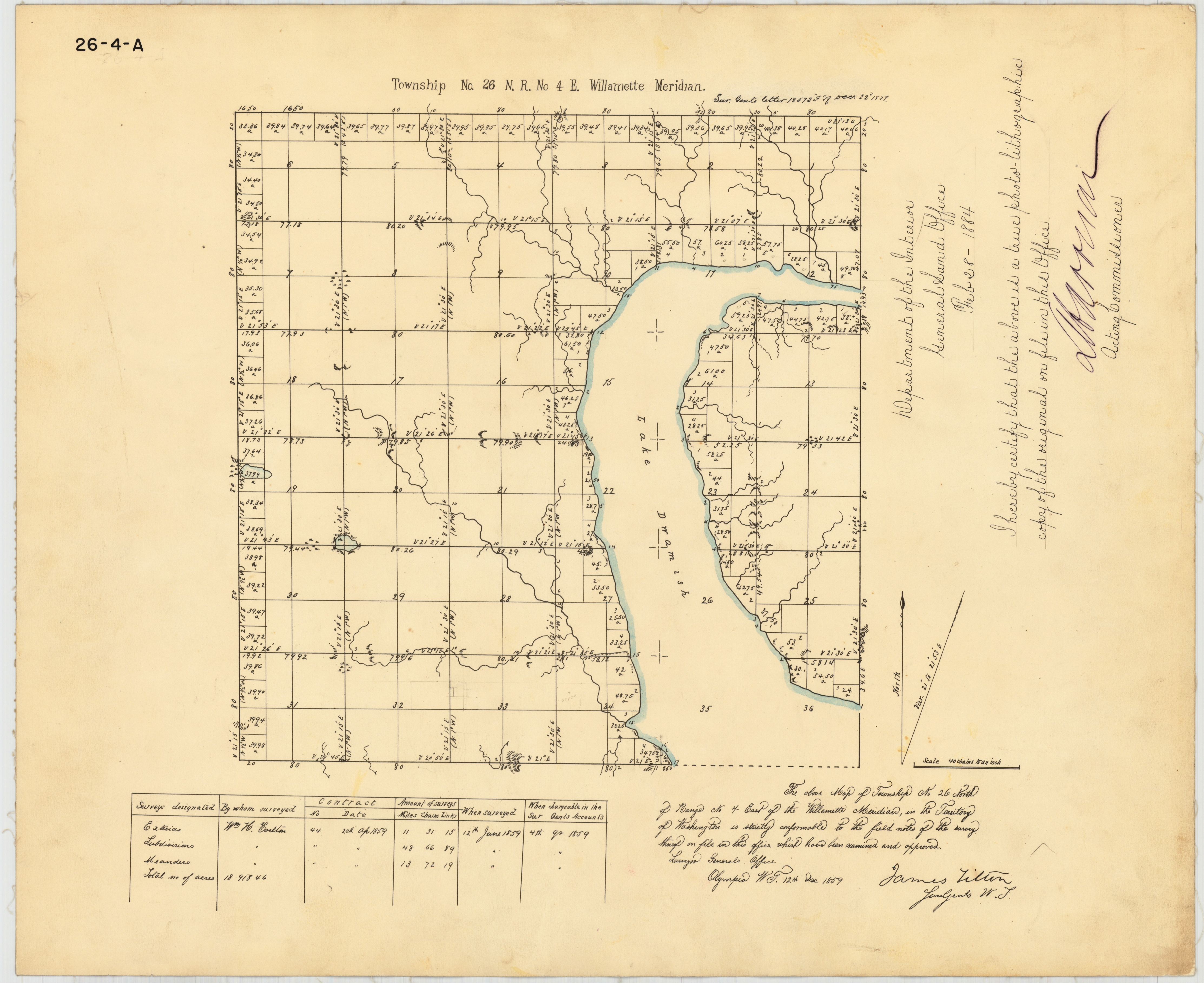
In 1858-1859 William H. Carlton led a survey team and drew this map of Township 26, north Seattle from 85th to 205th Streets.
On September 2, 1858, a team of surveyors stood at what is now the center point of Seattle’s Wedgwood business district on 35th Ave NE at NE 85th Street. The survey team of the year 1858 consisted of two chain carriers (men with a measuring device like that used to measure yardage in football games), two ax men who helped chop through underbrush, and the leader of the team listed as compass man, William H. Carlton.
Carlton’s hand-written field notes tell that the men set a post at this intersection because it was an important marker as they walked the east-west line between Township 25 which had already been surveyed from downtown Seattle out northward as far as 85th, and Township 26 which Carlton’s team surveyed in 1858 to 1859. That line between the two townships is now NE 85th Street at Wedgwood’s main business district along 35th Ave NE.
This blog post will tell why NE 85th Street is an important line and why the two halves of Seattle’s Wedgwood neighborhood, north and south of NE 85th Street, are somewhat different.