
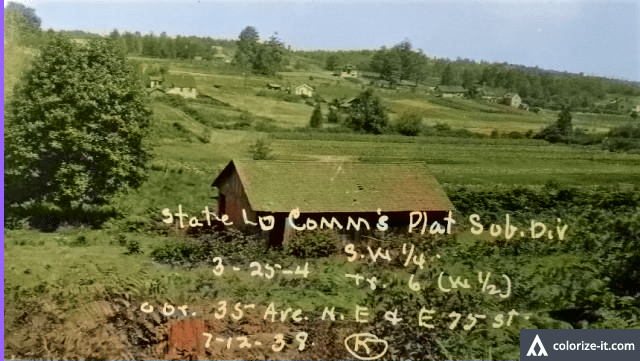
A 1938 photo by the King County Tax Assessor’s office, looking eastward and showing the corner which would later become Safeway. As of this year, there were no stores at the intersection and not all of the streets were put through.
Before There Was a Wedgwood Safeway: the Plat of Public Lands
A 1938 photo by the King County Tax Assessor’s office, looking eastward and showing the corner which would later become Safeway. As of this year, there were no stores at the intersection and not all of the streets were put through.
